On Friday, SWMBO and I took a 4.6 mile hike on a trail in the Delaware water gap region. The 1st leg of the trail was supposedly closed to traffic due the the spring storms in the area, knocking down trees as having the park officials deeming that the 1st section was not safe. However that didn't stop us to explore that section. As we neared the point where the waterfalls was, I recognized that this was a falls we visited last year, but approached today from a different route.
Camera 6DMKII w/Tamron 24-70mm SP1
The Start of the trail was at a Historical Millbrook Village
 IMG_8685.jpg by tesarver, on Flickr
 IMG_8686.jpg by tesarver, on Flickr
 IMG_8689.jpg by tesarver, on Flickr
The Hike not only had a small stream we followed by also had a few lakes that we walked around. This one is a 5 image pano, handheld.
 IMG_8693 Pano.jpg by tesarver, on Flickr
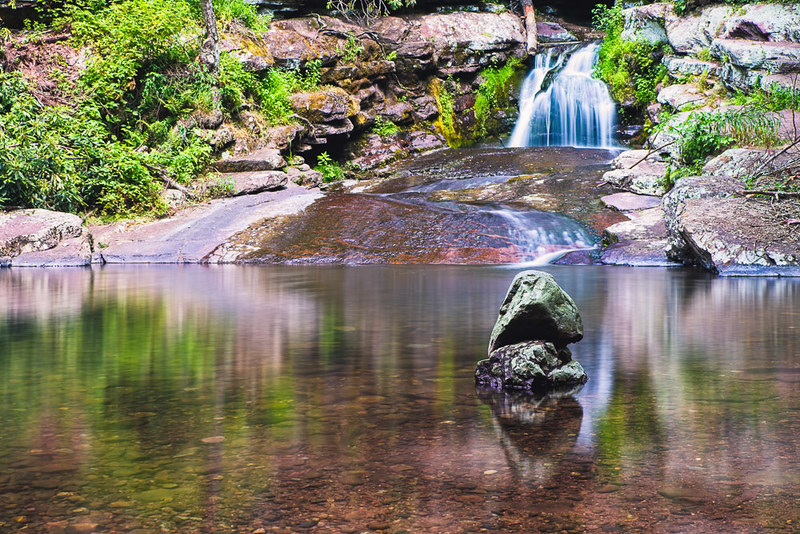
Then as we came up to the falls the top there was some ladder falls through the rocks, then the falls itself
 IMG_8725.jpg by tesarver, on Flickr
 IMG_8737.jpg by tesarver, on Flickr
Comments Welcomed
Tom
Camera 6DMKII w/Tamron 24-70mm SP1
The Start of the trail was at a Historical Millbrook Village
IMG_8685.jpg by tesarver, on FlickrIMG_8686.jpg by tesarver, on FlickrIMG_8689.jpg by tesarver, on FlickrThe Hike not only had a small stream we followed by also had a few lakes that we walked around. This one is a 5 image pano, handheld.
IMG_8693 Pano.jpg by tesarver, on FlickrThen as we came up to the falls the top there was some ladder falls through the rocks, then the falls itself
IMG_8725.jpg by tesarver, on FlickrIMG_8737.jpg by tesarver, on FlickrComments Welcomed
Tom


Comment